Get the bigger picture.
See what’s not visible


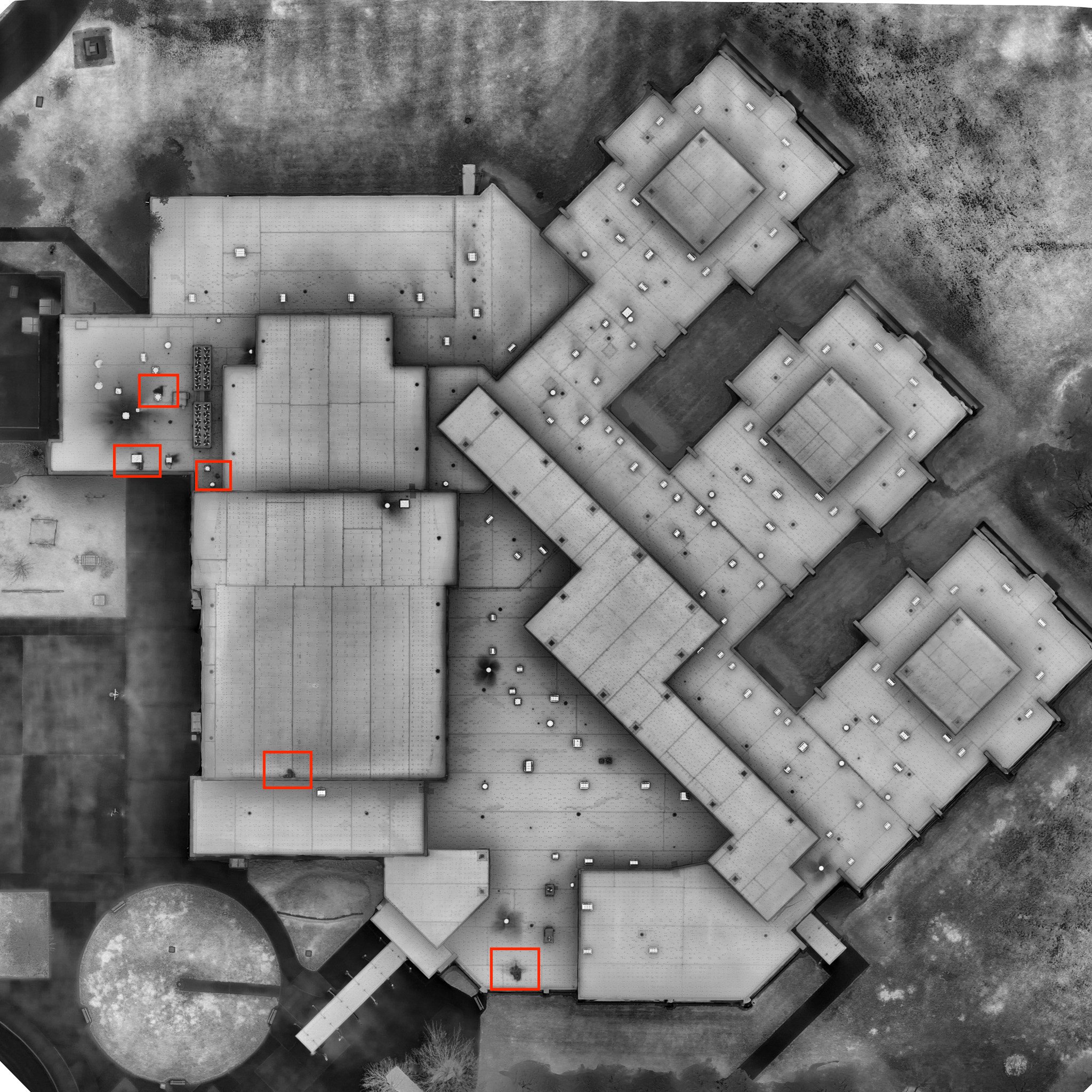
“He was finding really small anomalies that basically all corresponded to holes in the roof. I can‘t recall a single false positive. And he found a number of holes where they weren‘t reporting leaks.“
-Previous Client
Locating Thermal Anomalies
Our Aerial Infrared services utilize a drone with a high resolution Flir Boson 640×512 Thermal Imager for all thermal imaging qualitative applications. This allows us to obtain data that cannot be seen visibly. One valuable use case for thermal imaging is locating anomalies on roofing systems, areas that may contain trapped moisture or some form of moisture intrusion; as well as any other potential areas that need further investigation.
Combining a drone and a thermal imager allows you capture more of your target area more efficiently, as well as provide data that showcases larger areas of a roofing system or solar array system. Typically these surveys are conducted on foot with a hand held thermal camera. Not only does this take longer, it also cannot capture the square footage that a drone can.
-
![]()
Infrared/Thermal Map
-
![]()
Located Thermal Anomaly (Flat Roofing System)
-
![]()
Infrared/Thermal Map (Located Thermal Anomalies - Flat Roofing System)
-
![]()
Infrared/Thermal Map with located anomalies
-
![]()
Visual Map: Located loose roofing material
-
![]()
Visual Map: Ability to zoom in on located loose roofing material